Sectional chart symbols and airspace classes for Part 107
Quick answer
What sectional chart symbols do I need to know for the Part 107 test?
A Part 107 candidate needs to recognize seven airspace classes (B, C, D, E in three floor variants, and G), around a dozen special-use airspace and equipment symbols, three obstruction markings, and four NOTAM (Notice to Air Missions) categories. Each combination of line color and pattern tells you whether flying there needs LAANC authorization, a manual request, or nothing at all.
This reference is the data source behind the free sectional chart drill: every symbol below can show up as a question in that tool, in both untimed practice mode and timed exam-simulation mode. For the deeper explanation of what each airspace class means operationally, specifically for a Part 107 flight, see airspace classes for Part 107 pilots.
Nothing here is a reproduction of an actual FAA sectional chart excerpt. Airspace classifications, chart-symbol meanings, and 14 CFR (Code of Federal Regulations) Part 107 text are U.S. government facts and, per 17 U.S.C. 105, FAA works are public domain; every description below is our own plain-language rendering of a publicly documented charting convention, and every diagram is an original AI-assisted illustrative rendering (Gemini nb2), reviewed for accuracy before publishing, never a copy of a real chart or a competitor's artwork.
Airspace classes
The seven airspace-class footprints a sectional chart depicts around and away from airports. Identifying which one you are looking at is what the chart drill trains, because the class determines whether a Part 107 flight needs LAANC (Low Altitude Authorization and Notification Capability) authorization, a manual authorization request, or nothing at all.
| Diagram | Symbol / concept | How it looks on a sectional | What it means | Operational rule for Part 107 |
|---|---|---|---|---|
 | Class B airspace | Solid thick blue boundary lines, one ring per altitude segment, each ring labeled with its floor and ceiling in hundreds of feet (e.g. "70/SFC" meaning floor at the surface, ceiling 7,000 feet MSL). | The airspace around the nation's busiest airports, generally shaped like an upside-down wedding cake of stacked rings with different floor and ceiling altitudes tailored to that airport's traffic. | A Part 107 remote pilot may not operate in Class B airspace without prior air traffic control authorization, obtained through LAANC (Low Altitude Authorization and Notification Capability) where available or a manual authorization request otherwise. |
 | Class C airspace | Solid thick magenta boundary lines, tiered rings labeled with floor and ceiling altitudes similar to Class B. | Airspace around medium-activity airports with an operating control tower and radar approach control, normally two tiers: a surface area out to about 5 nautical miles and a shelf extending to about 10 nautical miles. | A Part 107 remote pilot needs prior authorization (LAANC or manual) before operating in Class C airspace. |
 | Class D airspace | Dashed thin blue boundary line, same line weight as the Class B ring but dashed rather than solid, with the floor/ceiling numbers shown inside a segmented circle. | Airspace around smaller airports with an operating control tower but no radar approach service, normally a single cylinder roughly 4 to 5 nautical miles in radius. | A Part 107 remote pilot needs prior authorization (LAANC or manual) before operating in Class D airspace. |
 | Class E airspace, surface area | Dashed thin magenta boundary line encircling the airport. | Controlled airspace that extends down to the ground around certain airports without a full-time control tower, existing to protect instrument approaches and departures. | A Part 107 remote pilot needs prior authorization (LAANC or manual) before operating within the surface area during the hours it is in effect. |
 | Class E airspace, 700 foot floor (shelf) | A shaded magenta fade (vignette); the darker edge of the fade marks the boundary where the floor steps from 700 feet AGL down toward the surface. | Class E airspace whose floor is 700 feet above ground level rather than the surface, shown as a shelf extending outward from an airport's controlled airspace. | Below 700 feet AGL in this footprint the airspace underneath is typically Class G and does not itself require Part 107 authorization; the shading marks where controlled airspace protection for other aircraft begins overhead. |
 | Class E airspace, 1,200 foot floor | The 1,200 foot floor is the default nationwide and is not itself outlined. Where it is outlined, a shaded blue fade (vignette) marks the boundary of the area, common in parts of the western United States, where there is no Class E at 1,200 feet at all and Class G extends up to 14,500 feet MSL instead. | Class E airspace whose floor is 1,200 feet above ground level, the most common floor for Class E airspace across the country away from airports. | Because Part 107 operations are capped at 400 feet AGL, most Part 107 flights stay under this Class E floor entirely and require no authorization on this basis alone. |
 | Class G airspace (uncontrolled) | No boundary line at all; Class G is the absence of any of the other airspace boundary symbols on the chart. | Uncontrolled airspace, the default classification for airspace not designated Class A, B, C, D, or E. | A Part 107 remote pilot may operate in Class G airspace up to 400 feet AGL without air traffic control authorization, subject to the rest of Part 107's operating rules. |
Chart symbols and special-use airspace
Boundary lines and area markings for special-use airspace and equipment-requirement zones, plus the two airport-tower symbols. Line color and pattern, solid versus dashed versus hashed, blue versus magenta, is the fastest way to identify one at a glance.
| Diagram | Symbol / concept | How it looks on a sectional | What it means | Operational rule for Part 107 |
|---|---|---|---|---|
 | Airport with an operating control tower | Airport reference dot rendered in blue rather than magenta, with a segmented-circle style outline for the runway layout. | The sectional-chart symbol identifying an airport that has an air traffic control tower in operation. | Signals that the surrounding airspace is very likely Class B, C, or D and that a LAANC or manual authorization check applies before flight nearby. |
 | Airport without a control tower | Airport reference dot rendered in magenta rather than blue. | The sectional-chart symbol identifying an airport that has no operating control tower. | A Part 107 remote pilot may still need to avoid interfering with manned traffic and give way to it, and should check for a Class E surface area, even though no tower authorization is required. |
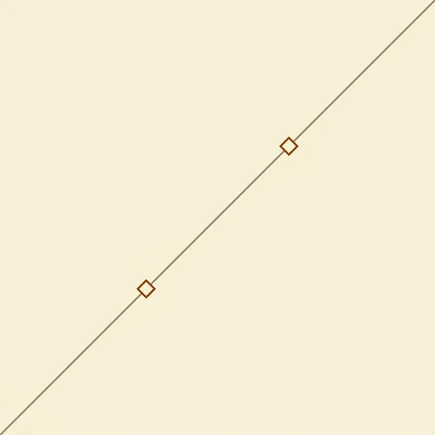 | Victor airway | A thin gray or black line connecting navigation aids, labeled with a V-number (e.g. "V23") along its length. | A federal airway used for low-altitude en route navigation between VOR (VHF Omnidirectional Range) stations, identified by a "V" followed by a number. | Victor airways sit well above the Part 107 400 foot AGL ceiling in nearly all cases; the drill flags them mainly so a candidate can rule them out as irrelevant to low-altitude UAS operations rather than mistake them for a surface hazard. |
 | Military Operations Area (MOA) | A magenta hashed (segmented) boundary line enclosing the area, labeled with the MOA's name. | Airspace established to separate certain military training activities from instrument flight rules (IFR) traffic. | An MOA does not itself restrict Part 107 operations the way a restricted or prohibited area does; other airspace and operating rules still apply, but situational awareness of concurrent military activity is a safety, not authorization, concern. |
 | Restricted area | A blue hashed boundary line enclosing the area, labeled "R" followed by a number (e.g. "R-2508"). | Airspace within which the flight of aircraft, while not wholly prohibited, is subject to restriction, typically for unusual, often invisible, hazards to aircraft such as artillery firing or guided missiles. | A Part 107 remote pilot may not operate in an active restricted area without authorization from the controlling or using agency; the area's active times and altitudes must be checked before flight. |
 | Prohibited area | A blue hashed boundary line enclosing the area, labeled "P" followed by a number (e.g. "P-56"). | Airspace within which flight is prohibited, established for security or other reasons associated with the national welfare, such as around the White House and the U.S. Capitol. | A Part 107 remote pilot may never operate inside an active prohibited area; there is no LAANC pathway for prohibited areas. |
 | Warning area | A blue hashed boundary line similar to a restricted area, labeled "W" followed by a number (e.g. "W-105"). | Airspace of defined dimensions extending from 3 nautical miles outward from the coast of the United States, containing activity that may be hazardous to nonparticipating aircraft, over international or U.S. territorial waters. | Warning areas are almost always over water beyond a Part 107 pilot's typical operating footprint; relevant mainly to coastal operations, where the same active-times check as a restricted area applies. |
 | Alert area | A magenta hashed boundary line enclosing the area, labeled "A" followed by a number (e.g. "A-291"). | Airspace that may contain a high volume of pilot training or an unusual type of aerial activity, alerting nonparticipating pilots to the activity. | An alert area does not restrict Part 107 flight by regulation; it is a heightened-awareness advisory rather than an authorization requirement. |
 | National Security Area (NSA) | A magenta dotted or hashed boundary line, labeled "NSA" with a name. | Airspace with defined vertical and lateral dimensions established at locations where increased security and safety of ground facilities is required, over which pilots are requested to voluntarily avoid flying. | Voluntary avoidance is requested by default, but the FAA can make flight in an NSA mandatory by regulation during elevated conditions; a Part 107 pilot should treat an active NSA the same as a restricted area until confirming its current status. |
 | Mode C veil | A thin solid magenta circle, 30 nautical miles in radius, centered on the Class B primary airport, distinct from the Class B rings themselves. | A 30 nautical mile radius area around certain busy Class B primary airports within which aircraft must generally be equipped with an altitude-encoding (Mode C) transponder. | The Mode C veil is a manned-aircraft equipment requirement, not itself a Part 107 authorization boundary; it is charted here so a candidate does not confuse it with a Class B ring on a symbol-identification question. |
 | Special-use airspace time and altitude tabulation | A small tabular box in the chart margin, one row per numbered special-use area on that chart sheet, not a symbol drawn over the terrain itself. | The panel printed on the chart margin listing each special-use area's number, altitude limits, and effective time, for MOAs, restricted areas, warning areas, and alert areas depicted on that chart. | Reading this tabulation, not just the boundary line, is how a pilot confirms whether a restricted or warning area is actually active at flight time; the drill tests reading the table alongside the boundary symbol. |
Obstructions
Towers, antennas, and other charted man-made hazards. Most are charted for manned aircraft flying well above the Part 107 400 foot AGL (above ground level) ceiling, but their base still marks a physical object a low-altitude flight must route around.
| Diagram | Symbol / concept | How it looks on a sectional | What it means | Operational rule for Part 107 |
|---|---|---|---|---|
 | Unlit obstruction, under 1,000 feet AGL | A small unfilled (outline only) obstruction symbol, a vertical mark topped with a circle, plotted at the obstruction's location with its height in feet MSL and AGL printed alongside. | A charted man-made obstruction such as a tower or antenna under 1,000 feet above ground level with no aviation obstruction lighting. | Obstructions this tall or taller are exactly what a Part 107 pilot's altitude planning must clear; unlit status is itself a hazard note for low-light operations. |
 | Lit obstruction, 1,000 feet AGL or higher | A filled (solid) obstruction symbol, larger than the under-1,000-foot symbol, with its height in feet MSL and AGL printed alongside. | A charted man-made obstruction 1,000 feet above ground level or higher with aviation obstruction lighting, the tallest single-obstruction category charted on sectionals. | Any obstruction charted at or above 1,000 feet AGL sits far above the Part 107 400 foot AGL ceiling; it is charted for manned aviation, but its base still marks a physical hazard a low-altitude UAS operation must route around. |
 | Group obstruction | The same vertical-mark-with-circle obstruction symbol, annotated "GROUP" alongside the tallest obstruction's height in the cluster. | Two or more obstructions in close proximity charted as a single group symbol rather than individually, common at wind farms and multi-tower antenna sites. | A group obstruction charts only the tallest member's height; a Part 107 pilot planning a flight near the site should assume additional shorter obstructions are present even though they are not individually plotted. |
NOTAM (Notice to Air Missions) types
NOTAMs are not printed on the base chart. They are live advisories a Part 107 pilot checks separately before every flight, and the knowledge test expects you to know which category carries regulatory weight.
| Diagram | Symbol / concept | How it looks on a sectional | What it means | Operational rule for Part 107 |
|---|---|---|---|---|
 | Temporary Flight Restriction (TFR) | Not printed on the base sectional chart itself; published separately as a graphic TFR and as text, and must be checked as a live overlay before every flight rather than assumed from the chart. | A NOTAM (Notice to Air Missions) that temporarily restricts flight in a defined area, commonly for VIP movement, wildfire suppression, major stadium events, or disaster response. | A Part 107 remote pilot may not operate within an active TFR's lateral and vertical limits without specific authorization from the agency that issued it, regardless of the airspace class underneath. |
 | NOTAM (D), distant NOTAM | Not a chart symbol; a text advisory retrieved from an official NOTAM source (faa.gov / notams.aim.faa.gov) tied to a specific airport identifier or facility. | A NOTAM disseminated for conditions affecting a specific facility or airspace, such as a runway closure, obstruction light outage, or airport equipment outage. | Reviewing current NOTAM (D) notices for the operating area is part of the Part 107 preflight-planning duty; an obstruction light outage NOTAM, for example, directly affects the safety of a low-altitude flight near that structure. |
 | FDC NOTAM (Flight Data Center) | Not a chart symbol; a text advisory carrying regulatory weight, distinct from the more routine NOTAM (D) category. | A regulatory NOTAM issued by the FAA's Flight Data Center, including amendments to charts, procedures, and most TFRs. | Most TFRs are published as FDC NOTAMs; treating an FDC NOTAM as merely informational rather than regulatory is a common test-taker mistake the ACS expects a candidate to avoid. |
 | Airport closure NOTAM | Not a chart symbol; a text advisory tied to the airport's identifier. | A NOTAM stating that an airport, or a specific runway or taxiway at it, is closed to operations. | Relevant to a Part 107 pilot mainly for situational awareness near the field; the underlying airspace class and its authorization requirement do not change just because the airport itself is closed. |
Sources
- FAA Aeronautical Chart User's Guide, faa.gov/air_traffic/flight_info/aeronav/digital_products/aero_guide/ (airspace classes, chart symbols, obstructions)
- FAA NOTAM search and information, faa.gov/air_traffic/flight_info/aeronav/notams/ (NOTAM types)
- Unmanned Aircraft General, Small (UAG) Airman Certification Standards, faa.gov/training_testing/testing/acs/media/uag_acs.pdf (task-area scope)
Chart-appearance descriptions were cross-checked against one independent secondary source on 2026-07-30 (see the site's data provenance file); primary source confirmation against the current FAA Aeronautical Chart User's Guide is the launch-week gate above.